
今天基于GDAL使用shp文件对栅格影像进行裁剪时出现了下面的问题,提示多边形自相交了
Warning 1: Ring Self-intersection at or near point 112.48666420300003 34.830899357000078ERROR 1: Cutline polygon is invalid.
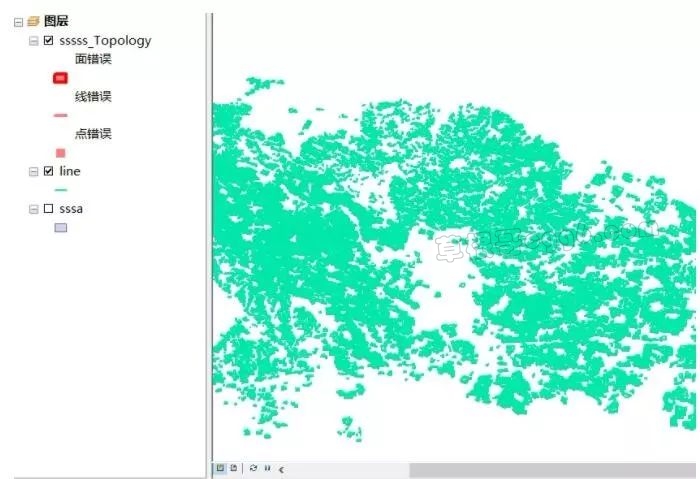
使用ArcGIS检查不到的原因
强大的ArcGIS居然检查不到,最终找到了这个原因。
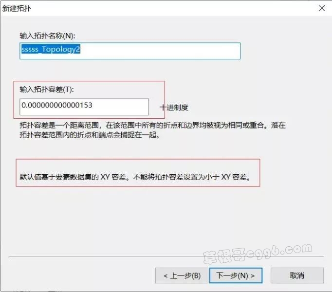
在ArcGIS 中无论是拓扑、shapefile文件、还是个人地理数据库都是设置有容差的,小于这个容差的自相交,都是无法检测到的。
解决方案
查阅了很多资料,最终整理了如下的解决方案。
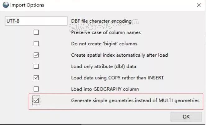
1.使用PostGIS将shape文件导入Postgresql数据库,记得导入的时候要勾选下面的选项。
2.从表里提取出自相交的多边形
CREATE TABLE temp1 as select * from m2 where ST_IsValid(geom) = false3.删除原表中的自相交图形
delete from m2 where ST_IsValid(geom) = false4.修复多边形
update temp1 set geom =ST_Buffer(geom, 0.0)-- update temp1 set geom =ST_MakeValid(geom) 也可以
5.修复完的数据恢复到原来的表
insert into m2 select * from temp16.最后通过PostGIS插件导出shp文件即可
结果检测
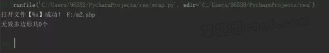
使用gdal对结果进行检测
from osgeo import ogr
shpFile = 'F:/m2.shp' # 裁剪矩形
# # # 注册所有的驱动ogr.RegisterAll()
def check_shp(): # 打开数据 ds = ogr.Open(shpFile, 0) if ds is None: print("打开文件【%s】失败!", shpFile) return print("打开文件【%s】成功!", shpFile) # 获取该数据源中的图层个数,一般shp数据图层只有一个,如果是mdb、dxf等图层就会有多个 m_layer_count = ds.GetLayerCount() m_layer = ds.GetLayerByIndex(0) if m_layer is None: print("获取第%d个图层失败!\n", 0) return # 对图层进行初始化,如果对图层进行了过滤操作,执行这句后,之前的过滤全部清空 m_layer.ResetReading() count = 0 m_feature = m_layer.GetNextFeature() while m_feature is not None: o_geometry = m_feature.GetGeometryRef() if not ogr.Geometry.IsValid(o_geometry): print(m_feature.GetFID()) count = count + 1
m_feature = m_layer.GetNextFeature() print("无效多边形共" + str(count) + "个")
check_shp()运行结果
本文来自投稿,不代表本站立场,如若转载,请注明出处: